Find the anomaly
Regional and near-bottom surveys locate promising areas and prioritise targets for follow-up.
SURFACE & NEAR-BOTTOM DATA
Before you drill.
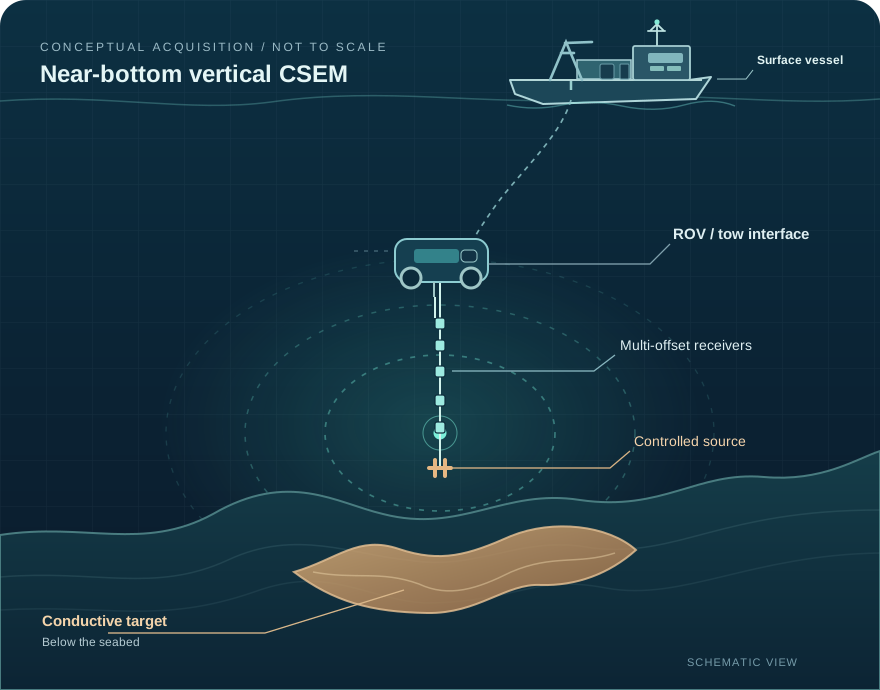
Marimet is developing a vertical marine CSEM system to constrain the geometry, depth, thickness and continuity of deep-sea sulphide deposits — turning selected anomalies into better-defined 3D targets.
Bathymetry, imagery and geochemistry help locate prospective areas. But an anomaly is not yet a well-defined mineral target. Before costly physical verification, explorers still need to understand what the subsurface might contain.
Regional and near-bottom surveys locate promising areas and prioritise targets for follow-up.
SURFACE & NEAR-BOTTOM DATAGeometry, burial depth, thickness and continuity of conductive mineralisation may remain unresolved.
THE SUBSURFACE GAPDrilling and sampling provide essential ground truth, but vessel time and repeated campaigns are expensive.
PHYSICAL EVIDENCEMarimet is designed to complement existing exploration tools, not replace geology or sampling. A focused conductivity appraisal step can help make each verification campaign more informative.
Identify & select
promising anomalies
Constrain subsurface
conductivity & geometry
Target drilling, sampling
& geological assessment
Conductivity is a geophysical proxy, not a direct measurement of metal grade or a compliant mineral-resource estimate. Physical sampling remains essential.
Vertical acquisition geometry, processing and inversion are being developed as a connected workflow for the appraisal of electrically conductive seabed mineralisation.
Vertically aligned transmitter and multi-offset receiver arrays are designed to provide a stable geometry for electromagnetic measurements.
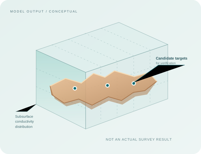
Numerical processing is intended to translate measured EM responses into interpretable subsurface conductivity distributions.
Interpreted conductivity anomalies can inform hypotheses about ore-body geometry and guide subsequent drilling and sampling.
The goal is not simply to collect more measurements. It is to create a quantitative subsurface interpretation that makes the next exploration decision more focused.
3D conductivity distribution
Constrain target location and possible subsurface extent.
Geometry & continuity hypotheses
Inform estimates of shape, depth and thickness subject to inversion uncertainty.
Focused verification plan
Prioritise where direct geological evidence can add the greatest value.
Marimet's proposed appraisal layer is most relevant where the target mineralisation is electrically conductive and targeted subsurface information can change the exploration plan.
Define high-priority conductive targets before planning costly drilling and sampling.
Complement mapping and detection capabilities with focused subsurface appraisal.
Study conductive seabed mineralisation with quantitative geophysical modelling.
Co-develop and validate an integrated offshore measurement and interpretation system.
A new company drawing on prior experience in electromagnetic geophysics, marine engineering, industrial technology and commercialisation.
Strategy, operations and partnerships; 20+ years in technology ventures, consulting and organisational development.
Get in touch ↗Deep-tech commercialisation, business development and international marine geophysics projects.
Business development, digital strategy and early-stage technology ventures.
Research and system design draw on expertise including Dr. Evgeniy Lisitsyn, Dr. Vladimir Kyasper and Dr. Alexander Petrov. Previous work by team members and contributors is distinct from Marimet's own development-stage results.
Exploring a conductivity-relevant target? Interested in technology validation or strategic collaboration? Start a conversation with the Marimet team.